TerraMars AI Explorer
Grade 11
Presentation
Problem
Throughout the last 4.5 billion years of Earth’s existence, issues related to resource sustainability have never been as prevalent as they are in the current day and age. Now, we need to understand what resource sustainability is to truly grasp the problem at hand. Resource sustainability is defined as “the long-term sustainability of a raw material that is either renewable (it can naturally replenish itself) or nonrenewable (it will eventually run out)”. This means that resource sustainability refers to the idea of using resources such as crops for food, fossil fuels for energy, or metals such as aluminum in a manner that will allow them to remain available to future generations. Essentially, the United Nations has stated that the global natural resource consumption is forecasted to rise 60% by 2060 compared with 2020 levels. Furthermore, this is accompaigned by material usage growing more than three times over the past 50 years at a rate of more than 2.3% per year.
Now, why is this so significant? Well, based on the trend of these statistics, there is a triple planetary crisis that will ensue, leading to the destruction of humanity as we know it. This triple planetary crisis is defined by the United Nations as the climate crisis, biodiversity loss, and pollution crisis. The climate crisis refers to how continually extracting resources contributes to the warming of the planet. This will then lead to long-term shifts in temperatures and weather patterns that, in the long-run, will completely alter the ecosystems on the planet. Biodiversity loss refers to the decline or disappearance of biological diversity, which includes animals, plants, and ecosystems. This will directly impact our food supplies and access to clean waters. Lastly, the pollution crisis is related to the harmful chemicals released into the atmosphere through many means such as extracting and refining resources. Currently, air pollution is the largest cause of death and premature death in the world. These statistics clearly lead to this idea that a transformation towards resource sustainability is not merely necessary but will urgently have to occur, otherwise eventually all of the resources available on Earth will be completely depleted, affecting the livelihoods of our future generations.
Based on the scale of this issue surrounding resource sustainability, we decided that we wanted to investigate and determine how we could present a potential solution to this issue. The led us to generate our research question.
Research Question
What method can be employed to effectively reach resource sustainability on Earth?
Method
Background Information
One of the methods employed for mineral exploration on Earth involves the usage of hyperspectral and multispectral analysis with remote sensing data. Essentially, remote sensing is the process of detecting and monitoring the physical characteristics of an area by measuring its reflected and emitted radiation at a distance, typically done through a satellite. Typically, many cameras and diverse instruments on these satellites take images of large areas on the Earth’s surface. These instruments utilize a variety of different wavelengths of light to detect different minerals in the ground, commonly referred to as bands. Basically, these bands are different ranges of the wavelengths of light that are captured by the satellite sensor, including visible light, infrared light, ultraviolet light etc. These bands allow us to tap into the spectral signatures of specific ore deposits, the amount of solar radiation that a mineral reflects, transmits, and emits due to its chemical composition. Hence, by measuring the tiny wavelength variations using remote sensing, a mineral’s spectral signature can often be identified from space. Currently, deep learning models are being utilzied to analyze large datasets containing the spectral analysis of satellites oribing Earth and aiding in mineral exploration via accurate mapping. For example, deep learning models based on images collected from the Sentinel-2 satellite boasted a 99% and 100% accuracy rate when classifying carbonated material in Pakistan.
Methodology
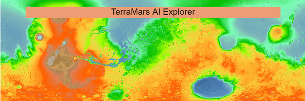
Using this idea of mineral exploration through spectral analysis, a method that can be employed to investigate our research question to effectively reach resource sustainability is to create an AI machine learning model that can predict and highlight specific ore deposits using satellite images on Mars. Essentially, the idea is use machine learning and spectral analysis to turn remote sensing data into a mineral exploration map for ore deposits. The plan is to use data from the CRISM instrument on the Mars Reconnaissance Orbiter, also known as the (MRO), which is one of the many satellites currently orbiting Mars that has spectral analysis equipment. We chose to use the CRISM instrument as it was designed to find minerals on the Martian surface by detecting the sunlight’s infrared spectrum. We then apply a variety of data preprocessing techniques and use a machine learning model to determine the many surface minerals on the planet.
So how is this project of mineral exploration on the Martian surface relevant to our research question? Well, by developing an AI that can effectively and efficiently locate resources on celestial bodies like Mars, we could accurately determine the amount of resources potentially available on any celestial body, given remote sensing data is available. This could aid in resource sustainability on Earth through two applications. The first application would involve the AI helping to fuel extraction missions to celestial bodies by accurately mapping the areas where there are abundant resources. This mapping would allow us to land at sites with greater ore deposits and alleviate the amount of resources being extracted from Earth. The second application of this AI is related to fuelling long-term space exploration missions. Essentially, when humans reach Mars or other celestial bodies, they could reduce the overall number of resources they take from Earth by planning to thrive off the natural resources present on these celestial bodies, once again preserving the finite number of natural resources on our planet.
Analysis
Analysis
With the analysis, we first need to start with collecting the data. For this, we extracted and scraped the data from the CRISM instrument on the MRO in which NASA provided a wide-ranged map of all locations and images of Mars. Using these images, we ran it through a machine learning model to predict the various different locations of unique resources that could be beneficial to Earth's demands. The machine learning model is a deep learning AI that consists of: data saving, data preprocessing (removing the parts of the image that the AI might not recognize), data training, and finally, predicting. With all of these images combined, we run a program that essentially examines the images pixel by pixel to analyze which pixel is correspondant to what. For example, when "Mg Olivine" is identified in any photo, it recognizes this, saves the pixel locations and finds the percentage of how many pixels of Mg Olivine there are within the entire photo. To finailize this data, we store this inside a database, find the individual ores commonly present in said resource, and display it to the viewer with a web-application.
Conclusion
Conclusion
In the end, our AI mineral exploration for Mars proves fruitful in producing images that detect locations of different minerals on Mars. It has the capabilities of predicting many locations of resources for future expeditions and can heavily aid in the amount of resources that humans can possibly use for everyday applications. This AI can help lead the planet to a more stable and sustainable future through means such as fuelling extraction missions to Mars by accurately mapping the areas where there are abundant resources and allowing us to land at sites with greater ore deposits and alleviate the amount of resources being extracted from Earth. In essence, the reserach question is fulfilled, with a method that can be employed to effectively reach resource sustainability involving the usage of an AI machine learning model for fuelling mineral exploration on the Martian surface.
Future Improvements
Some of the future improvements to this model include making a more sophisticated and detailed web-application that can tap into the databases of remote sensing data of other celestial bodies and use this AI mineral exploration model and process this data into different locations of minerals on multiple planets. Furthermore, the validity of the model could be determined with real-life data of humans or rovers extracting and confirming regions of minerals classified by the AI.
Citations
Citations
- (n.d.). The Mars Society. Retrieved March 15, 2024, from https://www.marssociety.org/
- (2009, June 3). YouTube: Home. Retrieved March 15, 2024, from https://www.researchgate.net/publication/369769010_Deep_Learning_based_Minerals%27_Recognition_and_Mapping_using_Sentinel-2_Imagery
- (2009, June 3). YouTube: Home. Retrieved March 15, 2024, from https://ts2.space/en/the-use-of-satellites-in-mining-and-mineral-exploration/
- Banus/crism_ml: Python code for training machine learning models on CRISM. (n.d.). GitHub. Retrieved March 15, 2024, from https://github.com/Banus/crism_ml
- Baumann, J. (n.d.). Mineral Exploration from Space. Esri. Retrieved March 15, 2024, from https://www.esri.com/about/newsroom/arcwatch/mineral-exploration-in-the-hyperspectral-zone/
- Global sustainable resource consumption needed urgently, UN report says | World Economic Forum. (2024, March 4). The World Economic Forum. Retrieved March 15, 2024, from https://www.weforum.org/agenda/2024/03/sustainable-resource-consumption-urgent-un/
- How many active or inactive artificial satellites are in Mars orbit? (2014, September 24). Space Exploration Stack Exchange. Retrieved March 15, 2024, from https://space.stackexchange.com/questions/5439/how-many-active-or-inactive-artificial-satellites-are-in-mars-orbit
- Natural-Resource Use and Environmental Impacts. (n.d.). One Planet network. Retrieved March 15, 2024, from https://www.oneplanetnetwork.org/SDG-12/natural-resource-use-environmental-impacts
- Sustainable Investing - Resource sustainability. (n.d.). Robeco.com. Retrieved March 15, 2024, from https://www.robeco.com/en-int/glossary/sustainable-investing/resource-sustainability
- What is remote sensing and what is it used for? | U.S. Geological Survey. (n.d.). USGS.gov. Retrieved March 15, 2024, from https://www.usgs.gov/faqs/what-remote-sensing-and-what-it-used
- What is Spectral bands? (n.d.). LocationIQ. Retrieved March 15, 2024, from https://locationiq.com/glossary/spectral-bands
- What is the Triple Planetary Crisis? (2022, April 13). UNFCCC. Retrieved March 15, 2024, from https://unfccc.int/news/what-is-the-triple-planetary-crisis
Acknowledgement
Acknowledgements (In Alphabetical Order)
- Irada Shamilove, Juniotech
- Gijs van den Dool, Senior Geospatial Data Scientist
- Tim Gubski, Princeton University
- Zainab Akhtar, Geospatial Scientist